| +91-612-2256999 | fmisc_bihar@yahoo.co.in | Site Map |
 |

|
| Home | About Us | WRD | River Basin Map | Contact Us | Rainfall Forecast |
|
1.End of Season Flood Report-2013
2.End of Season Flood Report-2012
3.End of Season Flood Report-2011
4.End of Season Flood Report-2010
5. End of Season Flood Report-2009
6. End of Season Flood Report-2007
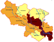
An end of season flood report was prepared with help of the information collected during the flood season 2008. This report serves as a source of information and a reference document for Water Resources Department (WRD) and other Stakeholder departments. It aims to fulfill two primary roles: a summary of the flood year 2008 and a collection of important data on the flood regime primarily through inundation maps, isohyets maps, maximum flood duration maps, maximum inundation extent maps and maps generated from global satellite data such as World View, Quick Bird, Modis and Terra X-SAR. Graphs showing river stages of different rivers of focus area during flood season and effect of rainfall in Nepal region on the river stages in Bihar have also been shown in the report. Some satellite pictures have been included in the report to show the river shifting behavior over the years which proved very helpful to Technical Advisory Committee and Scheme Review Committee in deciding the anti erosion schemes. Maps using Cartosat images of peak flood period were also prepared showing breaches in Kosi canals which may further be helpful in planning the future infrastructural repairs and development. 6. End of Season Flood Report 2007 A report was prepared with help of the information collected during the flood season 2007. This report serves as a source of information and a reference document for FMISC Technical Committee and Advisory Committee and also for a wider audience, such as the agencies responsible for disaster management, flood control and agriculture management. It aims to fulfill two primary roles: a summary of the flood year 2007 and a collection of important data on the flood regime primarily through inundation maps, maximum flood duration maps, maximum inundation extent maps and flood frequency maps etc. A special feature of the report is flood inundation mapping, maximum inundation map and duration of inundation map generated with the help of modern technology of GIS and Remote Sensing. 4. 1 Map Catalogue of Flood-2007 A catalogue of inundation maps produced by FMISC during the flood season of 2007 was prepared and disseminated to the user departments (Water Resources Department, Disaster Management Department and Agriculture Department). The maps cover the most flood prone parts of North Bihar, from Burhi Gandak river in the west to Kosi river in the east, covering about 26,000 sq. km. The focus area covers the districts of East Champaran, Sheohar, Sitamarhi, Muzaffarpur, Madhubani, Dharbanga, Samastipur, Supaul, Saharsa, Khagaria, and Begusarai. The inundation maps have been generated under a cooperative program with National Remote Sensing Center (NRSC), Hyderabad and shows administrative boundaries, rail and road network. The maps also show the embankment alignment, breaches reported by field officers and major rivers within the map coverage. The catalogue contains inundation maps derived from analysis of RADARSAT Synthetic Aperture Radar (SAR) data which enables viewing ground condition even under cloud cover. In summary, 22 nos. of inundation maps June(3), July(4), August(7), September(4), October(4)) were generated for flood 2007. The time series flood maps was analysed to produce maps showing flood intensity at block level and district level. Two inundation duration maps- one from 16th June to 18th July and other from 21st July to 9th August- were prepared for Agriculture Department.
|
|
